540 PM CST Mon Feb 25 2013
The National Weather Service in New Orleans has issued a
* Tornado Warning for...
central Jefferson Parish in southeast Louisiana...
northwestern Plaquemines Parish in southeast Louisiana...
this includes the city of Belle Chasse...
* until 615 PM CST
* at 537 PM CST...National Weather Service meteorologists detected a
severe thunderstorm capable of producing a tornado near LaFitte...
or 15 miles northeast of cut off...moving northeast at 55 mph.
* Other locations in the warning include but are not limited to Jean
Lafitte and Myrtle Grove
lundi 25 février 2013
dimanche 24 février 2013
Storm capable of producing a tornado Tornado Vortex Signature (LIX_F0)
| ID: | F0 |
| Location: | St. Bernard |
| Max: | 73 dBZ |
| Top: | 31,000 ft. |
| VIL: | 53 kg/m² |
| Chance of Severe Hail: | 100% |
| Chance of Hail: | 100% |
| Max Hail Size: | 4.00 in. |
| Speed: | 31 knots |
| Direction (from): | WSW (256) |
| This is today's forecast for organized severe thunderstorms over the contiguous United States. Please read the description of the risk categories for further information. You may find the latest Day 1 Outlook available as well as all Outlooks issued today online. | Today's Outlook |
 | |
| This is tomorrow's forecast for organized severe thunderstorms over the contiguous United States. Please read the description of the risk categories for further information. The latest Day 2 Outlookis available as well as all Outlooks that have been issued today. | Tomorrow's Outlook |
 | |
| This is the day after tomorrow's (day 3) forecast for organized severe thunderstorms over the contiguous United States. Please read the description of the risk categories for further information. The latest Day 3 Outlook is available as well as all Outlooks that have been issued today. Note: The 10% and greater probability thunder line is not included on the Day 3 Outlook. | Day 3 Outlook |
 |
European Storm Forecast Experiment http://www.estofex.org/
Storm Forecast
Storm Forecast
Valid: Mon 25 Feb 2013 06:00 to Tue 26 Feb 2013 06:00 UTC
Issued: Sun 24 Feb 2013 22:00
Forecaster: TUSCHY
Valid: Mon 25 Feb 2013 06:00 to Tue 26 Feb 2013 06:00 UTC
Issued: Sun 24 Feb 2013 22:00
Forecaster: TUSCHY
A level 2 was issued for the coastal areas of SW Albania, W Greece and NE Greece mainly for heavy to excessive rainfall amounts.
Two level 1 areas surround those level 2 areas mainly for an heavy rainfall risk, isolated large hail and an isolated tornado event.
Two level 1 areas surround those level 2 areas mainly for an heavy rainfall risk, isolated large hail and an isolated tornado event.
vendredi 22 février 2013
European Storm Forecast Experiment
Storm Forecast
Storm Forecast
Valid: Sat 23 Feb 2013 06:00 to Sun 24 Feb 2013 06:00 UTC
Issued: Sat 23 Feb 2013 00:55
Forecaster: PISTOTNIK
Valid: Sat 23 Feb 2013 06:00 to Sun 24 Feb 2013 06:00 UTC
Issued: Sat 23 Feb 2013 00:55
Forecaster: PISTOTNIK
A level 1 was issued for the Western shores of
Central Italy, Croatia, Bosnia and Montenegro mainly for excessive
convective precipitation.
A level 1 was issued for a belt from the Western Mediterranean via the Tyrrhenian Sea and Southern Italy into the Southern Adriatic Sea for severe wind gusts, large hail and an isolated tornado. http://www.estofex.org/
A level 1 was issued for a belt from the Western Mediterranean via the Tyrrhenian Sea and Southern Italy into the Southern Adriatic Sea for severe wind gusts, large hail and an isolated tornado. http://www.estofex.org/
dimanche 10 février 2013
Storm capable of producing a tornado Tornado Vortex Signature (LIX_X9)
| ID: | X9 |
| Location: | Washington |
| Max: | 58 dBZ |
| Top: | 20,000 ft. |
| VIL: | 25 kg/m² |
| Chance of Severe Hail: | 0% |
| Chance of Hail: | 20% |
| Max Hail Size: | 0.00 in. |
| Speed: | 33 knots |
| Direction (from): | SW (234) |
http://www.spc.noaa.gov/products/
| his is today's forecast for organized severe thunderstorms over the contiguous United States. Please read the description of the risk categories for further information. You may find the latest Day 1 Outlook available as well as all Outlooks issued today online. | Today's Outlook |
 |
| Current Weather Watches | |
|---|---|
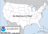
| This is the current graphic showing any severe thunderstorm and tornado watches which are in effect over the contiguous United States. Please read about the the purpose of our watches for further information. Details on all valid watches may be found on our Current Convective Watches page. |  |
| Current Mesoscale Discussions | |
| This is the current graphic showing any mesoscale discussions (MD's) which are in effect over the contiguous United States. Please read the description of the purpose of our MD's for further information. Details on all valid MD's may be found on our Current Mesoscale Discussions page. |  |
samedi 9 février 2013
Igoumenítsa (Ηγουμενίτσα - Δρέπανο) Thesprotia Greece (39.50 N, 20.27 E) (+/- 1 km) 09-02-2013 (Saturday) 15:06 UTC
http://www.youtube.com/embed/uO2mVNE76ow?rel=0
Inscription à :
Commentaires (Atom)


