dimanche 30 juin 2013
Jun 30, 2013 1300 UTC Day 1 Convective Outlook
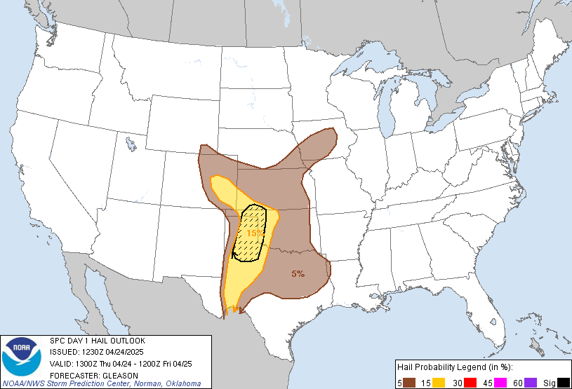 DAY 1 CONVECTIVE OUTLOOK
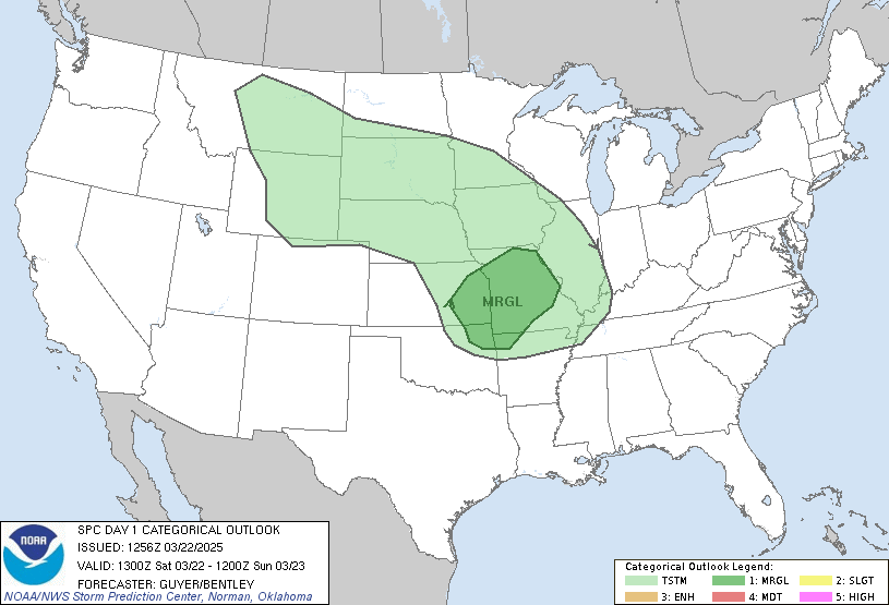
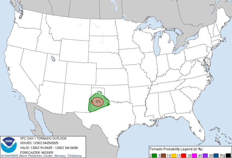
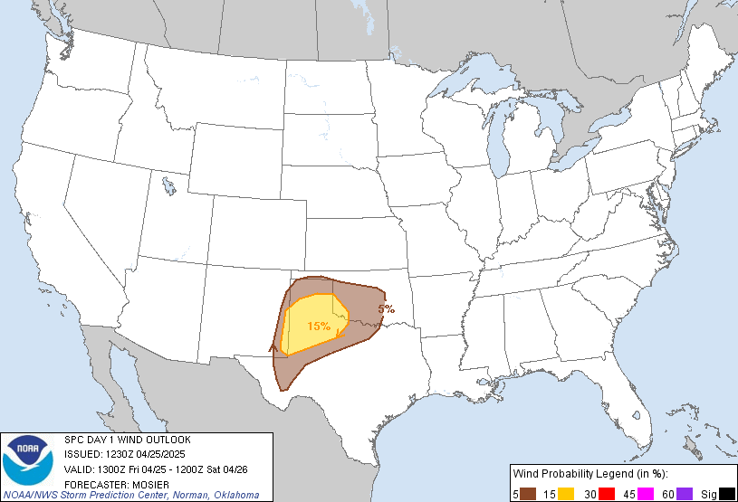
 NWS STORM PREDICTION CENTER NORMAN OK 0751 AM CDT SUN JUN 30 2013 VALID 301300Z - 011200Z ...THERE IS A SLGT RISK OF SVR TSTMS OVER PARTS OF THE CNTRL/SRN RCKYS AND ADJACENT HIGH PLNS... ...SYNOPSIS... FURTHER AMPLIFICATION OF WRN RIDGE/ERN TROUGH PATTERN EXPECTED THIS PERIOD AS RIDGE BUILDS FARTHER N INTO CANADA AND VORT MAX NOW OVER MO CONTINUES SSE INTO THE LWR TN VLY. AT LWR LVLS...A BROAD ANTICYCLONE WILL EXPAND SLOWLY S/SW FROM THE CANADIAN PRAIRIES INTO MUCH OF THE CNTRL U.S. AS A WEAK FRONT PERSISTS ALONG THE E SLOPES OF THE APPALACHIANS. UPSLOPE FLOW ON THE SW FRINGE OF THE ANTICYCLONE...AND CONVERGENCE ALONG THE APPALACHIAN FRONT...WILL SERVE TO FOCUS STRONG TO POSSIBLY SVR STORM DEVELOPMENT TODAY.
European Storm Forecast Experiment
Storm Forecast
Storm Forecast
Valid: Sun 30 Jun 2013 06:00 to Mon 01 Jul 2013 06:00 UTC
Issued: Sun 30 Jun 2013 04:18
Forecaster: VAN DER VELDE
Valid: Sun 30 Jun 2013 06:00 to Mon 01 Jul 2013 06:00 UTC
Issued: Sun 30 Jun 2013 04:18
Forecaster: VAN DER VELDE
A level 2 was issued for Moldova and southern Ukraine mainly for excessive precipitation and large hail.
A level 1 was issued for Turkey, Black Sea and eastern Balkan mainly for large hail.
A level 1 was issued for southern Sweden for spout-type tornadoes.
A level 1 was issued for central Finland mainly for marginal chances of excessive precipitation and large hail.
A level 1 was issued for the Norway-Finland border for a marginal chance of a tornado.
samedi 29 juin 2013
Severe thunderstorm :Watch http://weather.gc.ca/warnings/index_e.html?prov=ab

Public Weather Alerts for Alberta
Jun 29, 2013 1300 UTC Day 1 Convective Outlook


 DAY 1 CONVECTIVE OUTLOOK
 NWS STORM PREDICTION CENTER NORMAN OK 0742 AM CDT SAT JUN 29 2013 VALID 291300Z - 301200Z ...THERE IS A SLGT RISK OF SVR TSTMS OVER PARTS OF THE CNTRL HIGH PLNS... ...THERE IS A SLGT RISK OF SVR TSTMS OVER PARTS OF NEW ENGLAND... ...SYNOPSIS... AMPLIFIED WRN RIDGE/ERN TROUGH PATTERN WILL PERSIST THROUGH SUN. A SHORTWAVE TROUGH NOW NEARING THE WA/ORE CST WILL CONTINUE NE INTO BC LATER TODAY...WHILE A SERIES OF DISTURBANCES OVER THE UPR MS VLY ADVANCE SE INTO THE MID MS/LWR OH VLYS...FURTHER AMPLIFYING ERN TROUGH. AT LWR LVLS...A BROAD AREA OF CYCLONIC FLOW...WITH SEVERAL WEAK FRONTAL SURGES...WILL PREVAIL FROM NEW ENGLAND AND THE LWR GRT LKS REGION SW INTO THE LWR MS VLY. WEAK UPSLOPE FLOW ON THE WRN FRINGE OF THIS CIRCULATION WILL IMPACT THE CNTRL HIGH PLNS. STRONG TO LOCALLY SVR AFTN/EVE TSTMS COULD ACCOMPANY THE UPSLOPE FLOW IN THE HIGH PLNS...AND THE FRONTAL SURGES OVER PARTS OF THE EAST AND SOUTH.
vendredi 28 juin 2013
European Storm Forecast Experiment
Storm Forecast
Storm Forecast
Valid: Sat 29 Jun 2013 06:00 to Sun 30 Jun 2013 06:00 UTC
Issued: Sat 29 Jun 2013 00:33
Forecaster: PISTOTNIK
Valid: Sat 29 Jun 2013 06:00 to Sun 30 Jun 2013 06:00 UTC
Issued: Sat 29 Jun 2013 00:33
Forecaster: PISTOTNIK
A level 1 was issued for S Italy, Albania and W Greece for large hail and severe wind gusts.
A level 2 was issued for Macedonia, N Greece and parts of Bulgaria for large hail, severe wind gusts and excessive precipitation.
A level 1 was issued for the rest of Bulgaria and NW Turkey for large hail, severe wind gusts and excessive precipitation.
A level 1 was issued for parts of Moldova, the Ukraine, Belarus and Russia for large hail and excessive precipitation.
SYNOPSIS
An aged long-wave trough extends from Norway to Italy and slowly moves eastward. Two jet streaks dig from the Northern Atlantic into Denmark and from France into the Central Mediterranean, respectively. Geopotential falls in their left exit regions keep the long-wave trough still in shape during the forecast period, though it otherwise starts to disintegrate due to increasing QG subsidence ahead of pronounced ridging from Iberia to the British Isles.
At lower levels, cyclogeneses occur under the mentioned left exit regions over Southern Sweden and (less defined) over Macedonia. A Northwesterly flow advects cool and mostly stably stratified maritime air into Central Europe and the Central Mediterranean, before conditions start to warm and to clear over Southwestern Europe.
Further downstream, a rather diffuse cold front continues its slow eastward motion over Eastern Europe. Very warm and relatively moist air still advects North ahead of it over the Eastern Ukraine, Russia and Finnland.
Jun 28, 2013 0600 UTC Day 1 Convective Outlook
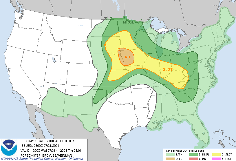
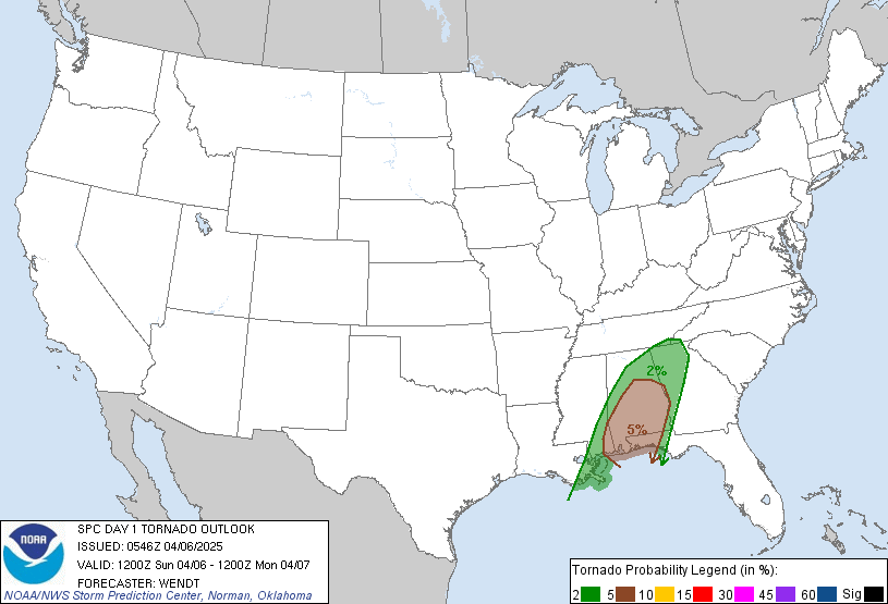
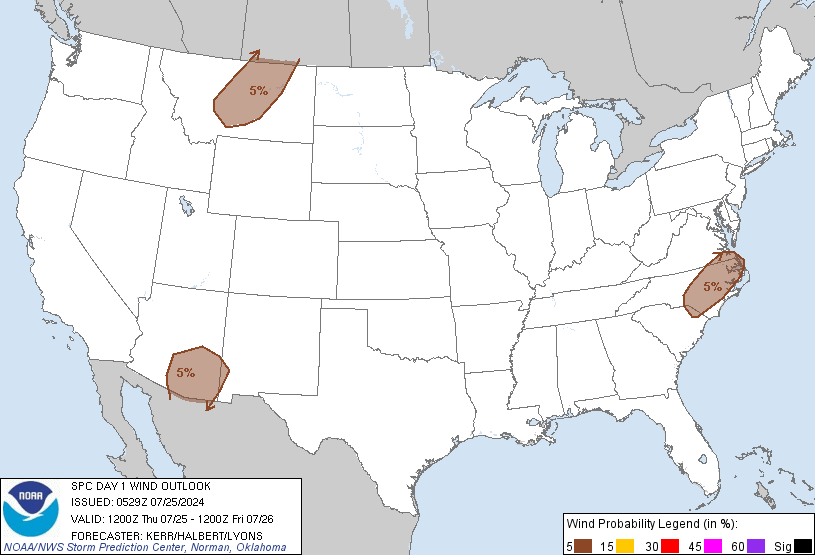
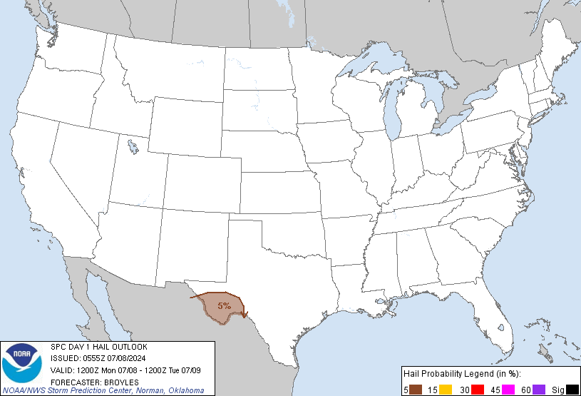 DAY 1 CONVECTIVE OUTLOOK
 NWS STORM PREDICTION CENTER NORMAN OK 1246 AM CDT FRI JUN 28 2013 VALID 281200Z - 291200Z ...THERE IS A SLGT RISK OF SVR TSTMS FROM A PORTION OF THE SERN STATES INTO THE MID ATLANTIC...ERN OH VALLEY AND A PART OF THE NERN U.S.... ...SYNOPSIS... SYNOPTIC PATTERN WILL UNDERGO FURTHER AMPLIFICATION FRIDAY WITH A RIDGE BUILDING OVER THE WRN STATES AND UPPER LOW DEEPENING IN THE EAST. SEVERAL SMALLER SCALE VORTICITY MAXIMA WILL MIGRATE THROUGH THE ERN U.S. UPPER LOW. A COLD FRONT WILL ADVANCE SWD THROUGH THE SRN PLAINS...LOWER MS AND TN VALLEYS WITHIN THE AMPLIFYING NWLY FLOW REGIME. FARTHER EAST AN AREA OF LOW PRESSURE WILL PERSIST OVER THE OH VALLEY AND NERN STATES WITH A LEE TROUGH EXTENDING SWD THROUGH THE MID ATLANTIC AND CAROLINAS.
jeudi 27 juin 2013
Tornados on lake okeechobee 6/27/2013 bass boats trying to outrun
Storm approach 6-27-2013
June 26th Tornado Warning Jackson, Mo
Dust storm. St.Petersburg, 27 june 2013
Manitowoc downtown hail storm 6 27 2013
Crazy Storm part 1
6/27/2013 NW Missouri Severe Storms
6/26/2013 Jackson County, IL Severe Storms
European Storm Forecast Experiment
Storm Forecast
Storm Forecast
Valid: Fri 28 Jun 2013 06:00 to Sat 29 Jun 2013 06:00 UTC
Issued: Thu 27 Jun 2013 21:39
Forecaster: TUSCHY
Valid: Fri 28 Jun 2013 06:00 to Sat 29 Jun 2013 06:00 UTC
Issued: Thu 27 Jun 2013 21:39
Forecaster: TUSCHY
A level 2 was issued for parts of Moldova, parts of W-Ukraine and S-Belarus mainly for large hail (a few extreme events possible), severe downbursts and heavy rainfall amounts.
A level 1 surrounds the level 2 mainly for similar risks but with less coverage and intensity.
A level 1was issued for W-Turkey mainly for a few damaging downburst events.
SYNOPSIS
Despite a weakening trend of the cyclonic vortex over C-Europe, no change in the pattern is forecast for the following 24 hours. Numerous impulses circle the main vortex and influence CI and coverage of DMC. Ridging over the Iberian Peninsula keeps conditions stable.
The quasi-stationary frontal boundary, which runs from Finland all the way to the W-Black Sea, transforms into a leisurely westward moving warm front from Belarus to the south which will be the focus for another round of severe thunderstorm development. Otherwise Atlantic fronts enter the scene from the NW and affect NW/C Europe but their role is more a decrease in DMC probabilities due to a stabilization of the low/mid-troposphere.
Tornado Warning !!! PA
613 PM EDT Thu Jun 27 2013
The National Weather Service in State College PA has issued a
* Tornado Warning for...
west central Lycoming County Pennsylvania...
central Clinton County Pennsylvania...
* until 645 PM EDT
* at 609 PM EDT...local law enforcement reported a tornado. The storm
containing the was near Mill Hall...moving north at 15 mph.
* Locations included in the warning...
Lock Haven...Cammal...Dunnstown...Glen Union...Hyner...Little Pine
State Park...McElhattan...Mill Hall and Waterville.
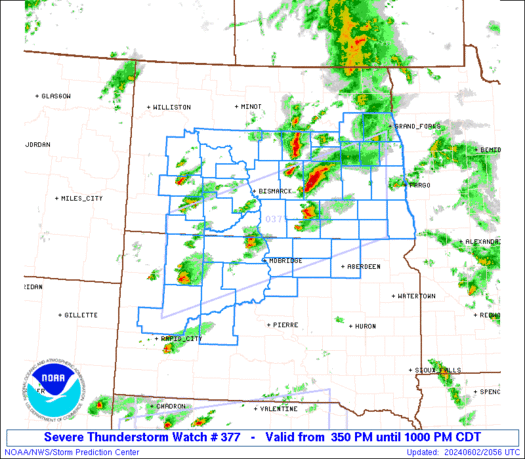
Tornado Watch 377
| ||||||||||||||||||
|
Tornado Warning!!! Pennsylvania
550 PM EDT Thu Jun 27 2013
The National Weather Service in State College PA has issued a
* Tornado Warning for...
north central Centre County Pennsylvania...
central Clinton County Pennsylvania...
* until 615 PM EDT
* at 546 PM EDT...National Weather Service Doppler radar indicated a
severe thunderstorm capable of producing a tornado. The storm
containing the possible tornado was near Beech Creek...moving
north at 15 mph.
* Locations included in the warning...
Lock Haven...Glen Union...Mackeyville and Mill Hall.
Jun 27, 2013 0600 UTC Day 1 Convective Outlook


 DAY 1 CONVECTIVE OUTLOOK
 NWS STORM PREDICTION CENTER NORMAN OK 0100 AM CDT THU JUN 27 2013 VALID 271200Z - 281200Z ...THERE IS A SLGT RISK OF SVR TSTMS OVER A PORTION OF THE CNTRL/SRN PLAINS INTO THE MID-LOWER MS VALLEY... ...THERE IS A SLGT RISK OF SVR TSTMS OVER A PORTION OF THE GREAT LAKES AREA... ...THERE IS A SLGT RISK OF SVR TSTMS OVER A PART OF THE SERN STATES... ...THERE IS A SLGT RISK OF SVR TSTMS FROM THE MID ATLANTIC INTO A PORTION OF THE NERN U.S.... ...SYNOPSIS... THE SYNOPTIC UPPER PATTERN WILL UNDERGO AMPLIFICATION THURSDAY WITH A GRADUAL BUILDING OF THE RIDGE OVER THE WRN U.S. AND DEEPENING OF TROUGH OVER THE ERN STATES. SHORTWAVE TROUGH OVER THE OH VALLEY REGION WILL MOVE SLOWLY EWD INTO THE MID-ATLANTIC AND NERN STATES. OTHER VORTICITY MAXIMA WILL DROP SEWD THROUGH THE UPPER MS VALLEY AND GREAT LAKES REGION. AT THE SFC A COLD FRONT WILL DEVELOP SWD THROUGH KS AND THE MID MS VALLEY REGION WITH AN OCCLUDED FRONT FARTHER NORTH INTO WI. FARTHER EAST A SFC LOW WILL ACCOMPANY THE SHORTWAVE TROUGH INTO THE MID ATLANTIC REGION WITH A LEE TROUGH EXTENDING SWD FROM THE LOW THROUGH VA AND THE CAROLINAS.
mercredi 26 juin 2013
European Storm Forecast Experiment
Storm Forecast
Storm Forecast
Valid: Wed 26 Jun 2013 06:00 to Thu 27 Jun 2013 06:00 UTC
Issued: Wed 26 Jun 2013 05:35
Forecaster: GATZEN
Valid: Wed 26 Jun 2013 06:00 to Thu 27 Jun 2013 06:00 UTC
Issued: Wed 26 Jun 2013 05:35
Forecaster: GATZEN
A level 1 was issued for eastern Romania and central Urkaine mainly for large hail and excessive precipitation.
A level 1 was issued for the southern Baltic States mainly for excessive precipitation.
A level 1 was issued for north-western Russia mainly for large hail.
SYNOPSIS
Two trough centres currently over the Alps and the North Sea will merge to a closed upper low across western central Europe today. This will be associated with weakening synoptic forcing across eastern central Europe today, and the frontal boundary will move eastward behind a frontal wave. Ahead of this frontal wave, warm and moist air masses will remain across south-eastern Scandinavia, whereas relatively dry low-level air masses will affect most of Europe. The cool air mass that dominates Europe is also associated with weak lapse rates due to mid-level subsidence. Steep lapse rates can be found in the wake of the Alps across northern Italy as well as over the high terrain of the Iberian Peninsula and Turkey.
mardi 25 juin 2013
Funnel cloud spotted near Villeroy, Quebec
 A line of severe thunderstorms moved through southern Quebec Monday evening, prompting Environment Canada to issue tornado warnings for the Lotbiniere and Thetford regions.
During that time, a funnel cloud was spotted near Villeroy, although no damage has been reported in the area.
At this time, Environment Canada is unable to confirm if the funnel cloud made contact with the ground.
The risk for severe thunderstorms continues through Tuesday, with thunderstorm watches in effect for parts of eastern Ontario and southern Quebec.
Heavy rain, intense lightning, hail and damaging winds are possible into the evening.
Meanwhile, strong winds over marine areas have been producing large tides in the Quebec City region, increasing the risk of coastal flooding. ...

Inscription à :
Articles (Atom)


