A powerful upper low is centered over NW Iberia Europe, while an upper ridge builds up over the rest of Europe merging with the Russian ridge.
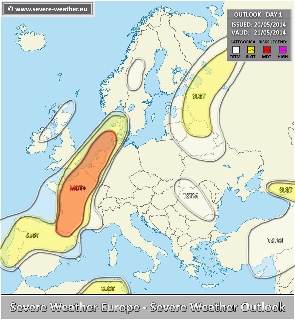
** A severe weather outbreak appears likely across France into Benelux on Wednesday afternoon / evening hours. **
A MDT+ risk has been issued for a large part of France into Benelux, the Netherands, extreme NW Germany and S Denmark with threat for widespread severe storms with threats for large to very large hail, severe winds, tornadoes (strong events possible) and heavy rain. Very strong deep layer shear, helicity and moderate instability are overlapping across the risk area. Once the capping inversion is eroded and the front pushes east, an outbreak of storms is likely. Upscale growth into one or two MCS clusters is possible towards the evening, enhancing severe wind threat while spreading northwards. Some uncertainties exist regarding the exact locations and coverage of the most robust storms, so an upgrade into HIGH risk is possible tomorrow morning if conditions improve.
A SLGT risk has been issued for surrounding areas to the MDT risk area and into N-W Iberia with threats for marginally large hail, severe winds, heavy rain and some tornado threat.
A SLGT risk has been issued for extreme NE Algeria into N Tunisia for isolated severe storms with threats for large hail, severe winds and heavy rain.
A SLGT risk has been issued from N Belarus across eastern parts of Baltic states into NW Russia with threats for severe winds, large hail and heavy rain.
A SLGT risk has been issued for parts of extreme SW Russia with threats for severe winds and large hail.
Aucun commentaire:
Enregistrer un commentaire