jeudi 14 mars 2019
Current Convective Watches

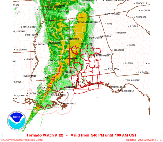
   URGENT - IMMEDIATE BROADCAST REQUESTED
   Severe Thunderstorm Watch Number 22
   NWS Storm Prediction Center Norman OK
   200 AM CDT Thu Mar 14 2019

   The NWS Storm Prediction Center has issued a

   * Severe Thunderstorm Watch for portions of
     southwest Arkansas
     northwest Louisiana
     northeast Texas

   * Effective this Thursday morning from 200 AM until 700 AM CDT.

   * Primary threats include...
     Scattered damaging wind gusts to 70 mph possible
     Isolated large hail events to 1.5 inches in diameter possible

   SUMMARY...A line of severe thunderstorms will move east across the
   watch area this morning posing a risk for damaging gusts and
   isolated large hail.

   The severe thunderstorm watch area is approximately along and 70
   statute miles east and west of a line from 15 miles north of
   Texarkana AR to 25 miles west southwest of Lufkin TX. For a complete
   depiction of the watch see the associated watch outline update
   (WOUS64 KWNS WOU2).

   PRECAUTIONARY/PREPAREDNESS ACTIONS...

   REMEMBER...A Severe Thunderstorm Watch means conditions are
   favorable for severe thunderstorms in and close to the watch area.
   Persons in these areas should be on the lookout for threatening
   weather conditions and listen for later statements and possible
   warnings. Severe thunderstorms can and occasionally do produce
   tornadoes.

   &&

   AVIATION...A few severe thunderstorms with hail surface and aloft to
   1.5 inches. Extreme turbulence and surface wind gusts to 60 knots. A
   few cumulonimbi with maximum tops to 500. Mean storm motion vector
   27035.

   ...Bunting
Current Mesoscale Discussions

 Mesoscale Discussion 0200
   NWS Storm Prediction Center Norman OK
   0237 AM CDT Thu Mar 14 2019

   Areas affected...Far Southern IN...Western KY...Far Northwest TN

   Concerning...Severe potential...Watch unlikely

   Valid 140737Z - 140900Z

   Probability of Watch Issuance...5 percent

   SUMMARY...A few isolated damaging wind gusts are possible across far
   southern IN, western KY, and far northwest TN during the next hour
   or two.

   DISCUSSION...Predominately shallow convection ongoing across western
   KY and far northwest TN has shown some intensification over the past
   hour or so. Given that the overall thermodynamic environment has
   shown little improvement over the past few hours, this
   intensification is likely a result of stronger forcing for ascent
   and increased vertical shear associated with the approaching cyclone
   and strengthening mid-level flow.

   Regional radar imagery reveals a striated linear structure, with
   several elongated bands of higher reflectivity. Forecast soundings
   suggest this activity is elevated above a shallow stable layer and
   the general expectation is for this activity to have little notable
   impact at the surface. However, storm interactions may briefly
   result in strong enough downdrafts to penetrate the stable
   low-levels, resulting in isolated gusts at the surface. Coverage of
   any damaging wind gusts is expected to be very isolated. Duration is
   also expected to be limited, as the downstream, low-level air mass
   across central KY and south-central IN becomes increasingly more
   stable.

   ..Mosier/Bunting.. 03/14/2019
Mar 14, 2019 0600 UTC Day 1 Convective Outlook

 Day 1 Convective Outlook
 NWS Storm Prediction Center Norman OK 1259 AM CDT Thu Mar 14 2019 Valid 141200Z - 151200Z ...THERE IS AN ENHANCED RISK OF SEVERE THUNDERSTORMS OVER PORTIONS OF THE TENNESSEE AND OHIO VALLEYS... ...SUMMARY... Strong to severe thunderstorms are possible from a portion of the Southeast U.S. into the Ohio Valley and southern Great Lakes. Damaging wind and a few tornadoes will be possible along with some hail. ...Synopsis... A very strong upper jet will rotate through the base of a potent synoptic upper trough and into the middle MS Valley, Ohio Valley and upper Great Lakes. Surface low within the exit region of this jet will develop northeastward and occlude over WI this afternoon. The trailing cold front will stretch from a surface low in IA early in the day southward through the lower MS Valley. This front will advance east reaching the lower Great Lakes southwest into the middle Gulf coast by the end of this period. ...Southeast U.S. through Ohio Valley and Great Lakes... Initial band of convection developing along warm conveyor belt from the TN Valley into the OH Valley will shift northeast and weaken early Thursday. However, ageostropic forcing accompanying an upstream jet exit region is already spreading through the Southern Plains, contributing to thunderstorms development along the front over northeast TX. This zone of ascent will continue to spread northeast during the early part of the day, and most models develop a secondary band of showers and thunderstorms over the middle MS Valley that shifts into the OH Valley by mid day. The timing and evolution of this early convection and areas of clouds complicate the forecast to some degree. Nevertheless, a corridor of mid-upper 50s dewpoints will advect north into the OH Valley along a strong low-level jet, with mid-upper 60s farther south across the Southeast States. MLCAPE should range from 1000+ J/kg over the Southeast States, where more diabatic heating is possible and higher dewpoints will reside, to around 500 J/kg farther north into the OH Valley and southern Great Lakes. Current indications are that additional thunderstorms will gradually intensify along and just ahead of the progressive front from the OH Valley southward into the TN Valley from late morning into the afternoon. The stronger forcing will exist along and north of the upper jet exit region over the OH Valley where instability will be more limited, while farther south weaker forcing will exist, but a destabilizing boundary layer and low-level convergence should be sufficient to initiate storms. Wind profiles will be very favorable for organized severe storms with 50+ kt effective bulk shear and 300-500 m2/s2 0-1 km storm relative helicity. Both discrete supercells and line segments are possible with damaging wind and a few tornadoes the main threats, mainly from late morning through early evening.
dimanche 10 mars 2019
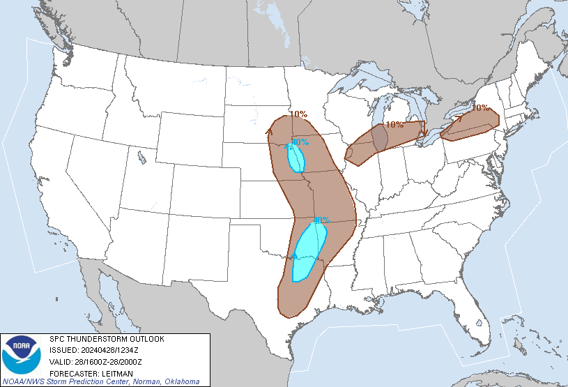
Convective Outlooks
| This is today's forecast for organized severe thunderstorms over the contiguous United States. Please read the description of the risk categories for further information. You may find the latest Day 1 Outlook available as well as all Outlooks issued today online. | Today's Outlook |
 | |
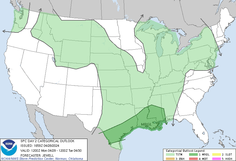
| This is tomorrow's forecast for organized severe thunderstorms over the contiguous United States. Please read the description of the risk categories for further information. The latest Day 2 Outlook is available as well as all Outlooks that have been issued today. | Tomorrow's Outlook |
 | |
| This is the day after tomorrow's (day 3) forecast for organized severe thunderstorms over the contiguous United States. Please read the description of the risk categories for further information. The latest Day 3 Outlook is available as well as all Outlooks that have been issued today. | Day 3 Outlook |
 |
samedi 9 mars 2019
Current Mesoscale Discussions

 Mesoscale Discussion 0166
   NWS Storm Prediction Center Norman OK
   0445 AM CST Sat Mar 09 2019

   Areas affected...portions of north Texas and eastern Oklahoma into
   southwest Missouri/northwest Arkansas

   Concerning...Severe Thunderstorm Watch 10...11...

   Valid 091045Z - 091145Z

   The severe weather threat for Severe Thunderstorm Watch 10, 11
   continues.

   SUMMARY...Local severe risk -- primarily in the form of hail --
   continues with stronger cells.

   DISCUSSION...Latest radar loop shows a loose band of convection --
   with embedded, stronger cells -- extending from far southwest
   Missouri south-southwest into north-central Texas at this time.  The
   strongest storms remain clustered near the DFW metroplex at present,
   particularly a storm moving out of Parker and into Tarrant County
   which has shown signs of mid-level rotation.

   As the upper system associated with this area of convection
   continues to shift eastward, expect the storms -- and local severe
   potential -- to continue.  Large hail remains the primary severe
   risk, which should remain the case over the next couple of hours.
vendredi 8 mars 2019
2019 0600 UTC Day 1 Convective Outlook

 ...THERE IS AN ENHANCED RISK OF SEVERE THUNDERSTORMS FROM THE LOWER
   OH VALLEY INTO WESTERN TN AND NORTHEAST MS...

   ...SUMMARY...
   Severe thunderstorms capable of tornadoes, large hail, and damaging
   gusts are possible across portions of the Mid South today through
   the early evening.  A strong tornado is possible from the confluence
   of the Ohio and Mississippi Rivers southward into parts of northern
   Mississippi and northwest Alabama.

   ...Synopsis...
   A vigorous, negatively tilted mid-level shortwave trough will move
   from the central/southern Great Plains to the lower MO Valley by mid
   afternoon and subsequently into the Great Lakes after dark.  An
   intense 90kt 500mb speed max will translate east-northeast from OK
   into the lower OH Valley by early evening.  In the low levels, a
   surface low will develop northeast from central KS to the IA/IL/MO
   border by 6pm and into the central Great Lakes overnight.  A warm
   front over the Mid South will advance northward into the lower OH
   Valley by peak heating and a composite dryline/Pacific front will
   arc south-southeast from the low into eastern AR and southwestward
   into east TX by mid afternoon before sweeping east across the OH
   Valley late.

   ...Eastern OK/TX into the mid-MS/lower OH Valleys...
   A complex forecast scenario with associated uncertainty
   appropriately describes the risk for severe thunderstorms and
   possible tornadoes across portions of the Mid South into the lower
   OH Valley today.  At the start of the period, a couple of clusters
   of strong to severe thunderstorms are forecast across western
   portions of the larger-risk area in parts of northeast TX into
   eastern OK/western AR.  Varying possible solutions are evident in
   model data whether all or parts of this activity moves downstream
   with intermittent intensification into the MS Valley during the day
   or whether some of this activity weakens on the southern portion
   near the Ark-La-Tex during the late morning.  Hail, wind, and
   perhaps a tornado or two are possible with the early-day storms over
   the Ark-La-Tex vicinity.

   Farther east, an adequately moist/destabilizing warm sector will
   spread north and northeast in wake of the warm front with surface
   dewpoints ranging from near 60 degrees F in the lower OH Valley to
   the middle 60s farther south into TN/AR/MS/AL.  Model guidance
   correspondingly indicates weaker buoyancy will exist farther north
   (MLCAPEs at or below 500 J/kg north of the OH river to 750-1250 J/kg
   farther south) but extreme low-level shear.  Hodographs become very
   large by early-mid afternoon with flow increasing from 70-90kt in
   the 850-500mb layer over the northern half of the Enhanced Risk
   area.  It seems plausible some attempts at storm development will
   occur during the afternoon near the leading edge of the mid-level
   dry slot.  If the stronger updrafts become sustained, they will
   likely evolve into supercells with tornado potential.  A corridor of
   possibility for supercell tornadoes (perhaps strong) appears
   greatest from the OH/MS confluence southward into northern portions
   of MS on the trailing portion of large-scale ascent moving away from
   the area.  As storms encounter weaker buoyancy farther east and
   northeast during the evening, a transition to linear structures
   capable primarily of damaging winds may occur.

   ..Smith/Squitieri.. 03/09/2019
lundi 4 mars 2019
3-3-19 Beauregard, Alabama Aerial Deadly Tornado - Close Range!
https://www.youtube.com/watch?v=COuETqZz-rg&t=0s
Attention!!!
Ce site utilise des cookies. Si vous continuez à naviguer sur ce site, vous consentez à notre utilisation de cookies en conformité avec notre politique.
This website uses cookies. If you continue to browse this site, you agree to our use of cookies in accordance with our policy.
dimanche 3 mars 2019

Mesoscale Discussion 0142
   NWS Storm Prediction Center Norman OK
   1035 AM CST Sun Mar 03 2019

   Areas affected...south-central and southeast LA

   Concerning...Severe potential...Watch likely

   Valid 031635Z - 031700Z

   Probability of Watch Issuance...80 percent

   SUMMARY...The severe risk is increasing over south-central and
   southeast LA.  A tornado watch may be needed soon for parts of
   southeast LA (near and north of Lake Pontchartrain).

   DISCUSSION...The 9am CST raob from Breaux Bridge, LA (Vortex2SE
   special raob) showed little remaining convective inhibition and a
   profile exhibiting 1100 J/kg MLCAPE.  Low-level shear is adequate
   but a tendency for veering low-level flow with time as the surface
   cyclone develops east across central AL will tend to limit hodograph
   size with time.  Nonetheless, a severe risk mainly in the form of
   strong to locally severe gusts and perhaps a tornado may accompany
   the more intense storms late this morning through the afternoon.

   ..Smith/Hart.. 03/03/2019
Mesoscale Discussion 141

Mesoscale Discussion 0141
   NWS Storm Prediction Center Norman OK
   0959 AM CST Sun Mar 03 2019

   Areas affected...southern and central AL...western FL
   Panhandle...southwest and west-central GA

   Concerning...Severe potential...Tornado Watch likely

   Valid 031559Z - 031800Z

   Probability of Watch Issuance...95 percent

   SUMMARY...The initial signs of discrete convective development are
   occurring late this morning in the warm sector.  Rapid environmental
   changes are forecast to occur between 10am CST/11am EST and the mid
   afternoon.

   DISCUSSION...Visible satellite imagery shows widespread cloud cover
   across the destabilizing warm sector to the south of the primary
   frontal zone where the surface low is forecast to develop eastward
   across central AL into north-central GA later today.  Surface
   dewpoints over the FL Panhandle and far southern AL have risen
   around 3 degrees F in the past hour and are indicative of strong
   poleward moisture advection occurring as the surface cyclone
   develops.  The warming/moistening are contributing to MLCAPE
   increasing from near 0 J/kg to upwards of 1000-1500 J/kg by
   early-mid afternoon.

   Late morning VAD data show around 35-45 kt southwesterly 700mb flow
   from KMOB/KBMX/KMXX/KEOX in central and southern AL but stronger
   flow (50-55 kt) is now being observed farther west in Jackson, MS
   (KDGX) and Slidell, LA (KLIX).  Models show the flow intensifying
   further over AL and GA this afternoon (55-60 kt 700mb).  The end
   result is a hodograph exhibiting little weakness (no veer-back-veer
   tendency or a weak layer of winds).  In summary, as moderate
   buoyancy and strong/veering flow through the profile combine with
   moist low levels, the threat for strong low-level mesocyclones
   associated with the discrete storms will increase, along with a
   corresponding risk for tornadoes of which a few may be strong.
Southern Mississippi Valley Sector

 Areas affected...southern MS into southwest AL

   Concerning...Severe potential...Watch possible

   Valid 031513Z - 031615Z

   Probability of Watch Issuance...40 percent

   SUMMARY...A locally damaging wind threat may develop this morning.
   Convective trends will be monitored in the short term as to whether
   a tornado watch will be needed prior to an expected tornado watch
   issuance time by the 11am-12pm period.

   DISCUSSION...Radar imagery shows an intensifying band of
   thunderstorms over southern MS from near the surface low
   southwestward along the cold front.  The developing band of storms
   is expected to move eastward near the primary frontal zone extending
   eastward from the surface low across south-central AL.  The maritime
   warm front near the I-10 corridor is becoming more diffuse with time
   but the airmass along and south of the front is where appreciable
   surface-based buoyancy resides.  As such, only weak instability is
   located currently over east-central MS to the east of Jackson.
   Nonetheless, as additional boundary layer warming/moistening occurs,
   the combination of a destabilizing boundary layer and the fast
   eastward motion of the squall line (40-45 kt) may facilitate an
   increased risk for horizontal momentum transport in the form of
   strong to locally severe gusts in the next 1-2 hours.  If this
   appears imminent, a tornado watch may be needed sooner than a
   currently anticipated tornado watch issuance time by 11am-12pm CST.
Attention!!!
Ce site utilise des cookies. Si vous continuez à naviguer sur ce site, vous consentez à notre utilisation de cookies en conformité avec notre politique.
This website uses cookies. If you continue to browse this site, you agree to our use of cookies in accordance with our policy.
Inscription à :
Commentaires (Atom)

