mercredi 31 juillet 2013
NWS North Platte, NE

A disturbance will move into western Nebraska tonight with increasing chances for showers and thunderstorms. Thunderstorms are expected Thursday and will focus along a frontal boundary into the afternoon and evening hours. Storms may become severe with large hail, damaging winds, and locally heavy rainfall.
lundi 29 juillet 2013
Tromba d'aria a Trezzo 29-07-2013
Storm above Culemborg (the Netherlands, Europe) at July 27th and 2
https://www.youtube.com/watch?v=RloOmEIi3uk From:Denise Cnossen
Thunderstorm, Nijmegen, Night from 27-07 to 28-07-2013
ORAGEDU 27/08/2013
Germany Hail Storm
ncredible East-Central Arizona Storm Chase - July 27, 2013
Shefcloud 27 Juli koningsbosch
Storm and Rainbow 7/26/13
dimanche 28 juillet 2013
European Storm Forecast Experiment
Storm Forecast
Storm Forecast
Valid: Mon 29 Jul 2013 06:00 to Tue 30 Jul 2013 06:00 UTC
Issued: Sun 28 Jul 2013 22:56
Forecaster: PUCIK
Valid: Mon 29 Jul 2013 06:00 to Tue 30 Jul 2013 06:00 UTC
Issued: Sun 28 Jul 2013 22:56
Forecaster: PUCIK
A level 2 was issued for Northern Italy mainly for large to very large hail, severe wind gusts, tornadoes and to the lesser extent and excessive precipitation.
A level 2 was issued for Northern Austria, Czech Republic and Southwestern Poland mainly for severe to extremely severe wind gusts, large to very large hail and to the lesser extent for excessive precipitation.
A level 2 was issued for Northwestern to Northern Poland mainly for large to very large hail, severe wind gusts and tornadoes.
A level 1 is surrounding level 2´s with isolated events of severe weather possible.
SYNOPSIS
With this day onward, the overall synoptic-scale pattern is going to change quite rapidly. Southern base of the strongly amplified trough over Atlantic will eject from Iberia towards Northern Italy and Central Europe, with strong flow over 20 m/s at 500 hPa surrounding it. With the rapid progression of the trough, strong lee cyclogenesis is simulated behind the Alps in the southerly flow and with increasing PVA, especially over SE Germany and N Austria. The trough of surface low will likely stretch towards Poland, with surface frontal system positioned at the rear of the low. Towards the afternoon and evening hours, surface low will move in accordance with the trough - i.e. towards the northeast. Behind the associated frontal system, which will accelerate substantially (especially its southern part), a ridge will quickly spread into Central Europe with strong pressure gradient.
vendredi 26 juillet 2013
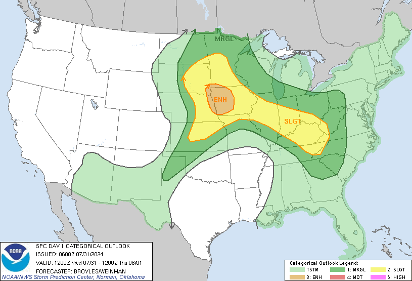
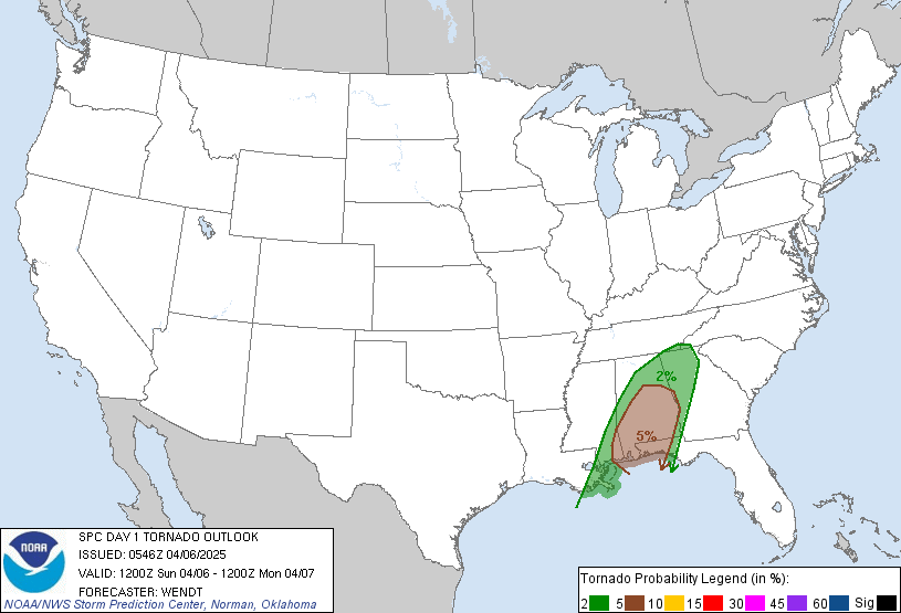
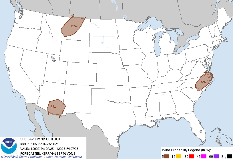
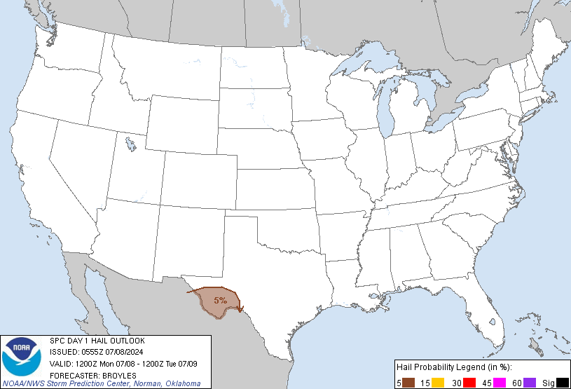
Jul 26, 2013 0600 UTC Day 1 Convective Outlook
 DAY 1 CONVECTIVE OUTLOOK
 NWS STORM PREDICTION CENTER NORMAN OK 1259 AM CDT FRI JUL 26 2013 VALID 261200Z - 271200Z ...THERE IS A SLGT RISK OF SVR TSTMS FROM NRN TX INTO A PORTION OF THE LOWER MS VALLEY... ...THERE IS A SLGT RISK OF SVR TSTMS OVER A PORTION OF WI... ...SYNOPSIS... UPPER TROUGH IS EXPECTED TO UNDERGO SIGNIFICANT AMPLIFICATION OVER THE UPPER MS VALLEY AND GREAT LAKES REGION. SEVERAL VORTICITY MAXIMA WILL MOVE SEWD THROUGH BASE OF THE AMPLIFYING UPPER TROUGH. A COUPLE OF SUCH FEATURES ARE NOW DROPPING SWD INTO NRN MN AND NRN ND...AND WILL REACH THE WRN GREAT LAKES REGION EARLY IN THE PERIOD. A WEAK SFC LOW WILL DEVELOP NWD THROUGH THE GREAT LAKES...EVENTUALLY OCCLUDING OVER SRN ONTARIO. AS UPPER TROUGH AMPLIFIES...COLD FRONT WILL SHIFT SWD THROUGH THE WRN GREAT LAKES...MID MS VALLEY AND SRN PLAINS REGION. ELSEWHERE...A SIGNIFICANT SHORTWAVE TROUGH CURRENTLY OVER KS WILL CONTINUE SEWD INTO THE LOWER MS VALLEY. A WEAK QUASI-STATIONARY FRONT WILL LIKELY PERSIST FROM THE GULF COAST STATES WNWWD INTO NERN TX DURING THE DAY.
Keraunos FRANCE:http://www.keraunos.org/previsions/prevision-orage-tornade-france-convective-outlook.html
Prévision des orages
Bulletin du 26/07/2013
VALIDITE : VEN 26 JUIL 2013 06Z -> SAM 27 JUIL 2013 06Z
EMIS LE : 26/07/2013 A 08H LOC
BULLETIN DU VENDREDI 26 JUILLET 2013
PREVISION GLOBALE TOUS RISQUES CONVECTIFS
PROBABILITE DE TORNADE

 PROBABILITE DE GRÊLE > 2 cm


QUALIFICATION GENERALE DU RISQUE CONVECTIF...
Risque d'orages très venteux en fin de journée et nuit prochaine dans le sud-ouest
ANALYSE SYNOPTIQUE ET DE MESO-ECHELLE...
Un thalweg d'altitude reste positionné au large de l'Atlantique et maintient un flux de sud-ouest ondulant sur l'ensemble de la France ce vendredi. Il contribue à advecter une masse d'air très chaude, d'origine tropicale sur la majeure partie du pays.
Cette anomalie d'altitude est pilotée par une branche de jet qui se renforcer la nuit prochaine et qui vient onduler entre le Golfe de Gascogne et le nord-ouest. En entrée droite de courant-jet, de noyaux de divergence significatifs circulent en altitude. L'approche de ce vigoureux axe de vents très forts en altitude contribue à une hausse des cisaillements profonds qui favorise l'organisation des orages.
Dans cet air très chaud, instable et bien forcé, un minimum de surface se creuse dans la soirée sur le centre-ouest du pays.
EMIS LE : 26/07/2013 A 08H LOC
| PREVISION GLOBALE TOUS RISQUES CONVECTIFS |
PROBABILITE DE TORNADE
|
 | 
PROBABILITE DE GRÊLE > 2 cm
 |
 |  |
QUALIFICATION GENERALE DU RISQUE CONVECTIF...
Risque d'orages très venteux en fin de journée et nuit prochaine dans le sud-ouest
Risque d'orages très venteux en fin de journée et nuit prochaine dans le sud-ouest
ANALYSE SYNOPTIQUE ET DE MESO-ECHELLE...
Un thalweg d'altitude reste positionné au large de l'Atlantique et maintient un flux de sud-ouest ondulant sur l'ensemble de la France ce vendredi. Il contribue à advecter une masse d'air très chaude, d'origine tropicale sur la majeure partie du pays.
Cette anomalie d'altitude est pilotée par une branche de jet qui se renforcer la nuit prochaine et qui vient onduler entre le Golfe de Gascogne et le nord-ouest. En entrée droite de courant-jet, de noyaux de divergence significatifs circulent en altitude. L'approche de ce vigoureux axe de vents très forts en altitude contribue à une hausse des cisaillements profonds qui favorise l'organisation des orages.
Dans cet air très chaud, instable et bien forcé, un minimum de surface se creuse dans la soirée sur le centre-ouest du pays.
European Storm Forecast Experiment
Storm Forecast
Storm Forecast
Valid: Fri 26 Jul 2013 06:00 to Sat 27 Jul 2013 06:00 UTC
Issued: Thu 25 Jul 2013 22:05
Forecaster: TUSCHY
Valid: Fri 26 Jul 2013 06:00 to Sat 27 Jul 2013 06:00 UTC
Issued: Thu 25 Jul 2013 22:05
Forecaster: TUSCHY
A level 2 was issued for parts of extreme N-Spain, parts of France, Belgium, the Netherlands, Luxembourg and NW Germany mainly for large to very large hail (hail diameter in excess of 5 cm possible), severe to damaging downbursts, excessive and potential flash flood producing rainfall amounts and an isolated tornado event.
A level 1 surrounds the level 2 for a similar hazard but with a low chance for extreme events.
A level 1 was issued for extreme SE-France and far N-Italy mainly for excessive rainfall amounts, isolated large hail and strong to severe wind gusts.
SYNOPSIS
A constant blocking pattern remains in place with strong ridging over S/C-Europe flanked by two stout troughs, one over the far E-Atlantic and the other one over far W-Russia.
At the surface, a quasi-stationary and wavy frontal boundary runs from the SE Bay of Biscay all the way to Denmark. Numerous small-scale disturbances evolve along that boundary and serve as foci for severe DMC. Probably the most pronounced surface pressure fall is expected during the night hours over the SE Bay of Biscay and SW France.
No other synoptic fronts play a role in today's thunderstorm forecast.
jeudi 25 juillet 2013
mercredi 24 juillet 2013
lundi 22 juillet 2013
Jul 22, 2013 1300 UTC Day 1 Convective Outlook
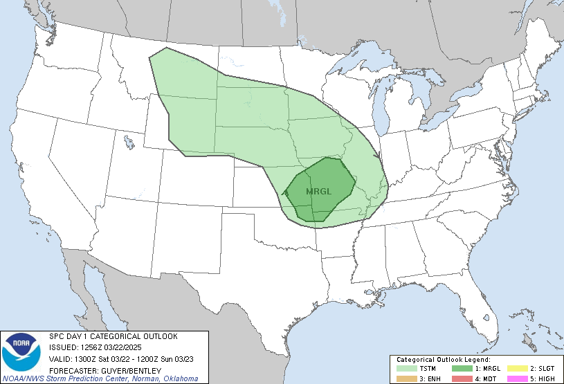
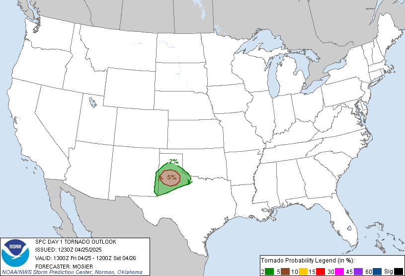
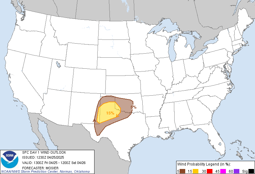
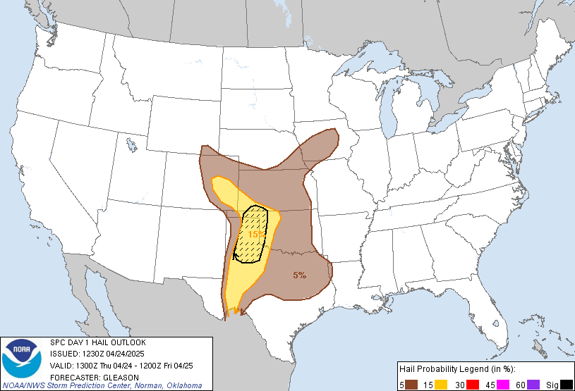 DAY 1 CONVECTIVE OUTLOOK
 NWS STORM PREDICTION CENTER NORMAN OK 0736 AM CDT MON JUL 22 2013 VALID 221300Z - 231200Z ...THERE IS A SLGT RISK OF SVR TSTMS FROM THE UPPER GREAT LAKES TO CNTRL PLAINS AND OZARK PLATEAU... ...SYNOPSIS... A LONG-WAVE TROUGH --ANCHORED BY AN UPPER-LEVEL LOW OVER NRN QUEBEC-- WILL BE MAINTAINED ACROSS ERN NORTH AMERICA THROUGH THE D1 PERIOD. UPSTREAM FROM THIS TROUGH...A BELT OF ENHANCED WNWLY MIDLEVEL FLOW WILL EXIST ACROSS THE NRN INTERMOUNTAIN REGION AND NRN PLAINS...BETWEEN AN UPPER-LEVEL LOW OVER THE GULF OF AK AND A BROAD LOW-AMPLITUDE RIDGE CENTERED OVER THE GREAT BASIN. A COUPLE WELL-DEFINED SHORT-WAVE TROUGHS ARE APPARENT WITHIN THIS SYNOPTIC-SCALE REGIME...ONE OF WHICH WILL AMPLIFY WHILE MOVING ACROSS ONTARIO...WHILE THE OTHER TRANSLATES FROM THE MID MS VALLEY TOWARD THE ATLANTIC COAST. ELSEWHERE...A VORTICITY MAXIMUM OVER WA WILL MOVE INTO THE NRN HIGH PLAINS WITH THIS FEATURE PRECEDED BY A WEAKER IMPULSE OVER WY WHICH WILL PROGRESS INTO THE CNTRL PLAINS. IN THE LOW LEVELS...A COLD FRONT ASSOCIATED WITH THE ONTARIO SHORT-WAVE TROUGH WILL ADVANCE EWD THROUGH THE UPPER MIDWEST AND MUCH OF THE UPPER GREAT LAKES. A DEVELOPING LEE CYCLONE OVER ERN CO/WRN KS WILL SLOW THE SEWD PROGRESSION OF THIS FRONT ACROSS THE MID MO VALLEY INTO CNTRL PLAINS. THE WRN EXTENSION OF THIS BOUNDARY WILL TRAIL NWWD ACROSS THE NRN HIGH PLAINS WHERE IT WILL REMAIN QUASI STATIONARY. FARTHER TO THE S...MESOANALYSIS REVEALS A WARM FRONTAL SEGMENT EXTENDING FROM THE CNTRL HIGH PLAINS LOW EWD ACROSS CNTRL KS WHERE IT LINKS WITH A CONVECTIVE OUTFLOW BOUNDARY EXTENDING SSEWD INTO NWRN AR AND THEN EWD INTO NWRN TN.
European Storm Forecast Experiment
Storm Forecast
Storm Forecast
Valid: Mon 22 Jul 2013 06:00 to Tue 23 Jul 2013 06:00 UTC
Issued: Sun 21 Jul 2013 23:15
Forecaster: TUSCHY
Valid: Mon 22 Jul 2013 06:00 to Tue 23 Jul 2013 06:00 UTC
Issued: Sun 21 Jul 2013 23:15
Forecaster: TUSCHY
A level 2 was issued for NE Algeria and N-Tunisia mainly for very large hail and severe downbursts. Local flash flooding is possible.
A level 1 was issued for far N-Spain, W-France, UK and parts of Ireland mainly for large hail, strong to isolated severe wind gusts and heavy to excessive rainfall amounts. An isolated very large hail event over W-France is possible. An isolated tornado event over NW-France and SW UK is possible.
A level 1 was issued for extreme SE France, S-Switzerland and extreme NW-Italy mainly for isolated large hail.
Numerous level 1s were issued for parts of C-Italy, Corsica and Sardinia mainly for isolated excessive rainfall amounts.
A level 1 was issued for parts of far W-Russia mainly for an augmented tornado risk.
SYNOPSIS
An omega-like blocking pattern continues over Europe although the ridge in-between does not look healthy at all. In fact a gradual weakening trend is forecast during the day and thunderstorm probabilities increase along its western/southern fringe.
Two upper troughs flank the high along its western and eastern fringes. Especially the western one (over the far E-Atlantic) provides increased thunderstorm probabilities during the forecast and also for the following days.
Numerous vortices with marginal cooler mid-level air cross the C-Mediterranean and the Aegean Sea from west to east and result in isolated to scattered thunderstorm activity over Italy and Greece.
EARTHQUAKE MAGNITUDE 6.5 HIT NEW ZEALAND TODAY JULY 21, 2013
https://www.youtube.com/watch?v=jupPvYJIOyg
21/07/2013 Tornade impressionante a GAFSA TUNISIE
(Sand Storm)https://www.youtube.com/watch?v=b1VjB0INnao
dimanche 21 juillet 2013
Storm capable of producing a tornado Tornado Vortex Signature (MBX_F1) Manitoba
| ID: | F1 |
| Location: | NONE |
| Max: | 62 dBZ |
| Top: | 35,000 ft. |
| VIL: | 61 kg/m² |
| Chance of Severe Hail: | 70% |
| Chance of Hail: | 100% |
| Max Hail Size: | 1.50 in. |
| Speed: | 23 knots |
| Direction (from): | W (272) |
Storm capable of producing a tornado
Tornado Vortex Signature (MBX_F1)
| ID: | F1 |
| Location: | NONE |
| Max: | 61 dBZ |
| Top: | 33,000 ft. |
| VIL: | 48 kg/m² |
| Chance of Severe Hail: | 50% |
| Chance of Hail: | 100% |
| Max Hail Size: | 1.00 in. |
| Speed: | 23 knots |
| Direction (from): | WNW (291) |
Tornado Warning!!! in effect for east central McHenry County ND
627 PM CDT sun Jul 21 2013
...A Tornado Warning remains in effect for east central McHenry
County until 645 PM CDT...
At 625 PM CDT...a confirmed tornado was located 6 miles southwest of
Towner...or 38 miles south of Bottineau...moving east at 30 mph.
Hazard...damaging tornado and quarter size hail.
Source...weather spotters confirmed tornado.
Impact...Mobile homes will be damaged or destroyed. Damage to
roofs...windows and vehicles will occur. Flying debris will
be deadly to people and animals. Tree damage is likely.
This tornadic storm will affect mainly rural areas of east central
Tornado Warning!!!central North Dakota
628 PM CDT sun Jul 21 2013
The National Weather Service in Bismarck has issued a
* Tornado Warning for...
north Central Grant County in south central North Dakota
central Morton County in south central North Dakota
* until 700 PM CDT/600 PM MDT/
* at 525 PM MDT...a severe thunderstorm capable of producing a
tornado was located 7 miles south of Almont...or 34 miles west of
Bismarck....and moving southeast at 40 mph.
Hazard...tornado and Golf Ball size hail.
Source...radar indicated rotation.
Rotating Wall Cloud,,,,ND
arge wall cloud to
approx 20 mi to my nw - is
rotating as i have watched for 5
minutes.
approx 20 mi to my nw - is
rotating as i have watched for 5
minutes.
Tornado Storm Report N D
2013-07-21 18:42:00 EDT
Lat/Lon: 48.36,-100.90
Location: Mchenry
Aircraft reports a small tornado on the ground... nearing houses 6 to 7 miles NNW of Granville (bis)
NWS Bismarck, ND

Thunderstorms are expected this afternoon into this evening across much of western and central North Dakota. Some of the storms could be severe, especially from central into eastern North Dakota. If you have outdoor activities planned today, remain alert and be sure to check for the latest weather conditions.
Tornado Warning!!! central North Dakota
539 PM CDT sun Jul 21 2013
The National Weather Service in Bismarck has issued a
* Tornado Warning for...
northern McHenry County in north central North Dakota
* until 630 PM CDT
* at 538 PM CDT...a severe thunderstorm capable of producing a
tornado was located 7 miles east of Deering...or 21 miles northeast
of Minot....and moving east at 35 mph.
Hazard...tornado and quarter size hail.
Source...weather spotters reported funnel cloud.
Tornado Watch in Saskatchewan and Manitoba
Risk of tornadoes late this afternoon into early this evening.
Conditions are favourable for the development of severe thunderstorms with the potential to produce tornadoes.
These severe thunderstorms will also have the potential to produce very large hail..Flooding rain..Deadly lightning and powerful winds. Use this time to secure outdoor property and to ensure family members and co-workers are prepared to take action should the severe weather approach.
Environment Canada continues to monitor the situation closely for severe thunderstorm development and possible tornado warnings. Please continue to monitor your local media or weatheradio for further updates.
Should severe weather approach or if you feel threatened do not wait for warnings to take action..Take shelter immediately.
Should you spot a funnel cloud or tornado...And only if it is safe to do so...You can call 1-800-239-0484 to report your sighting. Please note this phone number is for reporting severe weather only.
A cold front moving through Extreme Southeastern Saskatchewan is expected to push into Southwestern Manitoba and trigger severe thunderstorms late this afternoon. Large hail, damaging winds, torrential downpours and frequent lightning are possible with any storms that develop. In addition, there is the potential for tornadoes to develop in extreme Southwest Manitoba, where a tornado watch remains in effect.
Severe storms should move out of the province by late this evening.
Tornado risk in Manitoba and Saskatchewan: Forecasters,,,,,,,,,,,,,,,,,,,,,,,,,,,,,,,,,,,,,,,,,http://www.theweathernetwork.com/news/articles/tornado-risk-in-manitoba-and-saskatchewan-forecasters/9682/

Tornado watches currently in place
Staff writers
Sunday, July 21, 2013, 5:08 PM -
There's a stormy afternoon in store for parts of Saskatchewan and Manitoba.
Environment Canada issued tornado watches for parts of the south of those two provinces, and even in the morning were warning that the brewing storms could be powerful enough to spark tornado watches.
Areas currently under a tornado watch are: Carlyle, Oxbow, Carnduff, Bienfait, Stoughton, Estevan, Weyburn, Radville, Milestone, Melita, Boissevain, Turtle Mountain Provincial Park.
Jul 21, 2013 2000 UTC Day 1 Convective Outlook
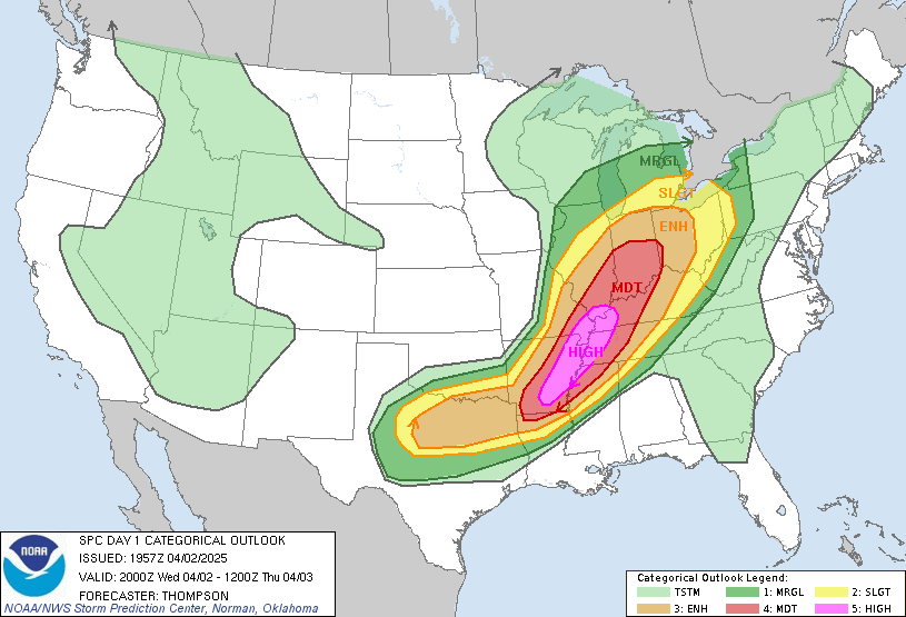
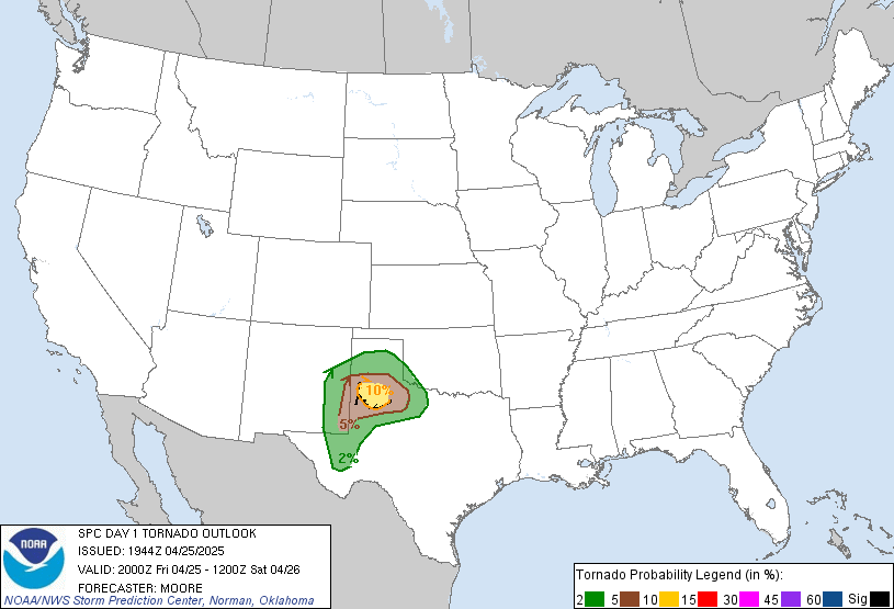
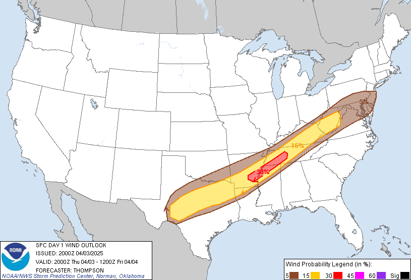
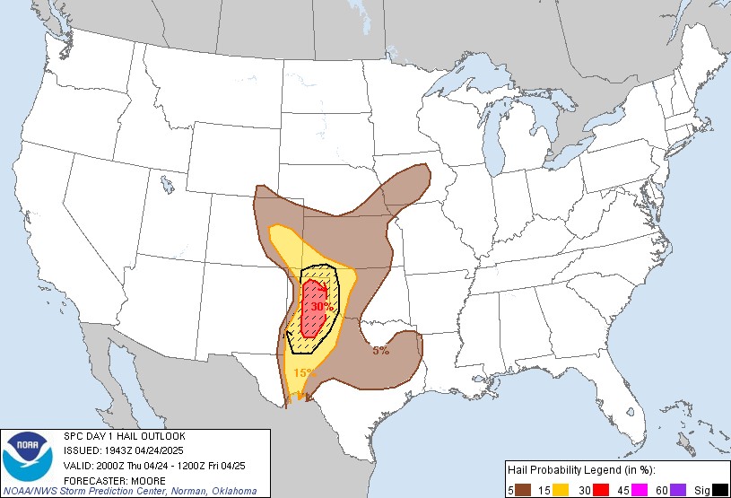 DAY 1 CONVECTIVE OUTLOOK
 NWS STORM PREDICTION CENTER NORMAN OK 0250 PM CDT SUN JUL 21 2013 VALID 212000Z - 221200Z ...THERE IS A SLGT RISK OF SVR TSTMS ACROSS PARTS OF THE NRN PLAINS... A COUPLE OF CHANGES HAVE BEEN MADE TO THE OUTLOOK FOR THIS ISSUANCE. THE FIRST CHANGE IS TO EXTEND THE NRN PLAINS SLIGHT RISK AREA WWD TO NEAR THE MT-ND STATE-LINE TO ACCOUNT FOR STRONG CONVECTION SOUTH OF WILLISTON. THE SECOND CHANGE TO THE OUTLOOK IS TO REMOVE THE 5 PERCENT WIND DAMAGE PROBABILITY FROM PARTS OF WV AND WRN VA. THIS AREA HAS BEEN WORKED OVER BY A LINE OF STRONG STORMS CURRENTLY MOVING ACROSS CNTRL VA. ..BROYLES.. 07/21/2013 .PREV DISCUSSION... /ISSUED 1127 AM CDT SUN JUL 21 2013/ ...SYNOPSIS... MODELS INDICATE THAT A SEASONABLY STRONG MID/UPPER JET...NOW EXTENDING FROM THE LOWER GREAT LAKES AND ST. LAWRENCE VALLEY REGION INTO THE NORTH ATLANTIC...WILL CONTINUE TO SHIFT EASTWARD DURING THIS FORECAST PERIOD. AS DEEP LAYER FLOW FIELDS WEAKEN ACROSS THE NORTHEAST...THEY WILL REMAIN GENERALLY WEAK ELSEWHERE ...BUT STRONGEST IN A CONFLUENT...LARGELY ZONAL...REGIME ACROSS THE NORTHEASTERN PACIFIC THROUGH THE CANADIAN/U.S. BORDER AREA. A SIGNIFICANT EMBEDDED SHORT WAVE IMPULSE THAT SUPPORTED CONSIDERABLE THUNDERSTORM ACTIVITY ACROSS SOUTHERN ALBERTA AND SASKATCHEWAN...AS IT DUG TO THE LEE OF THE CANADIAN ROCKIES...IS FORECAST TO REMAIN PROGRESSIVE AND GRADUALLY TURN EASTWARD ALONG AND JUST NORTH OF THE INTERNATIONAL BORDER...INTO WESTERN ONTARIO BY LATE TONIGHT. THE PRIMARY LOW-LEVEL BAROCLINIC ZONE ASSOCIATED WITH THE DEPARTING EASTERN IMPULSE APPEARS LIKELY TO STALL ACROSS PARTS OF THE LOWER GREAT LAKES INTO NEW ENGLAND. BUT AT LEAST SOME DRYING ASSOCIATED WITH A LEADING...WEAK CONVECTIVELY ENHANCED BOUNDARY APPEARS TO HAVE GENERALLY SHIFTED TO THE SOUTH OF THE STRONGER RESIDUAL MID-LEVEL FLOW...INTO THE OHIO VALLEY AND NORTHERN MID ATLANTIC COAST REGION. STEEP LOW TO MID-LEVEL LAPSE RATES ASSOCIATED WITH DEEP BOUNDARY LAYER MIXING ARE GENERALLY CONFINED ALONG AND NORTH OF RESIDUAL SUBTROPICAL RIDGING EXTENDING ALONG AN EAST-WEST AXIS ACROSS THE CENTRAL PACIFIC COAST INTO THE CENTRAL ROCKIES. BUT A GRADUAL EASTWARD ADVECTION OF THIS AIR MASS...AS STRONGLY CAPPING ELEVATED MIXED LAYER AIR...IS EXPECTED ACROSS MUCH OF THE CENTRAL PLAINS BY LATE TONIGHT.
samedi 20 juillet 2013
European Storm Forecast Experiment
Storm Forecast
Storm Forecast
Valid: Sat 20 Jul 2013 06:00 to Sun 21 Jul 2013 06:00 UTC
Issued: Fri 19 Jul 2013 20:57
Forecaster: TUSCHY
Valid: Sat 20 Jul 2013 06:00 to Sun 21 Jul 2013 06:00 UTC
Issued: Fri 19 Jul 2013 20:57
Forecaster: TUSCHY
A level 2 was issued for NE Spain mainly for large to very large hail, severe downbursts, heavy rainfall amounts and an isolated tornado event.
A level 1 surrounds the level 2 mainly for the similar risks but with no extreme events expected.
A level 1 was issued for N-Morocco, N-Algeria and N-Tunisia mainly for an isolated but very large hail and severe downburst event.
A level 1 was issued for parts of France, Switzerland, parts of Austria and Italy mainly for large hail, strong to severe downbursts and heavy rainfall amounts. An isolated excessive rainfall event is possible. An isolated tornado event is possible, too.
A level 1 was issued for parts of Moldova, parts of the Ukraine into extreme W-Russia mainly for a few large hail and strong to severe wind gust reports.
SYNOPSIS
Another day is in store where a pronounced blocking takes place in the steering flow regime over Europe. A strong deep and warm high pressure area over the North Sea remains essentially unchanged regarding strength and placement compared to yesterday. The only sign of movement/expansion is seen along its southern fringe, where rising heights are forecast over Benelux and Germany. Along its southern fringe, the leftovers of the previous blocking event still meander to the ESE over S/C France and Italy. In fact, the strongest vortex will be the one over N-Italy with a closed circulation and a cold thermal print at 500 hPa, whereas the rest over S-France resembles more an elongated channel with cooler mid-levels (east-est aligned).
The strong upper trough over E/NE Europe continues to amplify and it approaches the northwestern part of the Black Sea during the overnight hours. This feature tries to constrict into a cut-off low, but another impulse approaches Norway/Sweden from the NW and probably delays any cut-off process at least beyond our forecast period.
An upper level ridge over far N-Africa expands a bit to the north and covers parts of the W-Mediterranean. A very hot and well mixed continental/desert air mass remains in place with convection once again being confined to the mountain areas along the coast.
At the surface, the southward blasting cold front gradually approaches Romania/Bulgaria with significantly drier postfrontal air affecting most parts of E-Europe. More synoptic fronts enter the scene from Norway/Sweden like a warm front, which will cross the Baltic Sea around midnight. Ongoing prefrontal low/mid tropospheric CAA and approaching WAA from the west result in more stable conditions spreading E/SE-wards (convective-wise).
vendredi 19 juillet 2013
Une météo propice à la formation d’orages,,,,,,,,,,,,,http://www.meteomedia.com/nouvelles/articles/une-meteo-propice-a-la-formation-dorages/9565/
MétéoMédia
Jeudi 18 juillet 2013 à 19 h 43 - Vendredi, toutes les conditions seront réunies pour que des orages violents se développent au Québec.
Le passage successif d’un front chaud et d’un front froid provoquera une instabilité dans l’air.
Ce contraste de températures amènera un potentiel d’orages violents. « C’est surtout le long du front froid que l’on retrouvera les orages les plus costauds. », explique Amélie Bertrand, météorologue chez MétéoMédia.
Parmi tous les éléments météorologiques qui surviennent lors du passage d’une cellule orageuse, ce sont surtout les vents qui seront à surveiller dans ce cas-ci. Des averses de grêle sont également possibles.
« Ce temps pourrait être favorable à la formation de microrafales et de tornades. Ce sera donc à surveiller tout au long de la journée. », ajoute la météorologue.

Public Weather Alerts for Quebec - south,,,,,http://weather.gc.ca/warnings/index_e.html?prov=sqc
 Severe Thunderstorm Warning,Warning ,Watch,
Public Weather Alerts for Ontario - south,,,http://weather.gc.ca/warnings/index_e.html?prov=son..

 Severe Thunderstorm Warning ,Watch and .....
Public Weather Alerts for Ontario - north .http://weather.gc.ca/warnings/index_e.html?prov=non
Jul 19, 2013 0600 UTC Day 1 Convective Outlook


 DAY 1 CONVECTIVE OUTLOOK
 NWS STORM PREDICTION CENTER NORMAN OK 1252 AM CDT FRI JUL 19 2013 VALID 191200Z - 201200Z ...THERE IS A SLGT RISK OF SVR TSTMS FROM THE CNTRL GREAT LAKES TO NRN NEW ENGLAND... ...GREAT LAKES TO NRN NEW ENGLAND... WHILE STRONGEST MID LEVEL HEIGHT FALLS ARE EXPECTED TO REMAIN NORTH OF THE U.S. BORDER ACROSS ONTARIO...SRN EXTENT OF LARGE SCALE FORCING SHOULD SPREAD ACROSS THE GREAT LAKES DURING THE DAY. LATEST SHORT-RANGE MODEL GUIDANCE SUGGESTS MID LEVEL FLOW WILL INCREASE TO AROUND 50KT ALONG A CORRIDOR FROM SRN WI...ACROSS NRN LOWER MI INTO NRN MAINE BY 20/00Z. THIS BELT OF INCREASING LARGE SCALE FLOW WILL COINCIDE WITH ADVANCING COLD FRONT THAT IS EXPECTED TO ADVANCE ESEWD AHEAD OF PROGRESSIVE SHORT-WAVE TROUGH. EARLY IN THE PERIOD IT APPEARS SCT TSTMS MAY BE NOTED ALONG COLD FRONT FROM SERN MN...NEWD ACROSS NRN WI INTO CNTRL ONTARIO. THIS ACTIVITY COULD BE LOCALLY STRONG AND PERHAPS EVEN PRODUCE MARGINALLY SEVERE HAIL OR GUSTY WINDS. HOWEVER...MORE SIGNIFICANT CONVECTION IS EXPECTED LATER IN THE DAY AS BOUNDARY LAYER HEATING IS EXPECTED TO ENHANCE INSTABILITY SUCH THAT ANY STORMS THAT FORM ALONG THE COLD FRONT WILL DO SO WITHIN A THERMODYNAMIC ENVIRONMENT SUPPORTIVE OF ROBUST UPDRAFTS. FORECAST SOUNDINGS ACROSS PORTIONS OF LOWER MI SUGGEST CONVECTIVE TEMPERATURES...NEAR 90F...SHOULD BE REACHED AND WITH LOW LEVEL FRONTAL CONVERGENCE SCT THUNDERSTORMS ARE EXPECTED BY 19Z. DEEP WLY FLOW AND SFC-6KM BULK SHEAR ON THE ORDER OF 25KT FAVOR ORGANIZED MULTI-CELL UPDRAFTS AND PERHAPS EVEN WEAK SUPERCELLS...THROUGH ENVIRONMENTAL SHEAR FAVORS LINE SEGMENTS. DAMAGING WINDS AND HAIL ARE THE PRIMARY THREATS WITH THIS ACTIVITY. DOWNSTREAM ACROSS UPSTATE NY INTO NRN NEW ENGLAND...WLY LLJ IS EXPECTED TO INCREASE MARKEDLY AHEAD OF COLD FRONT WITH FLOW APPROACHING 50KT AT 850MB ACROSS NRN MAINE BY 18Z. WHILE FLOW WILL BE DECIDEDLY VEERED LOW LEVEL SHEAR IS EXPECTED TO BE FAIRLY STRONG AND ANY CONVECTION THAT EVOLVES ACROSS THIS REGION COULD CERTAINLY ROTATE. LOW LEVEL WARM ADVECTION MAY CONTRIBUTE TO DISCRETE SUPERCELL ACTIVITY AHEAD OF COLD FRONT THOUGH MORE CONCENTRATED ACTIVITY SHOULD BE CONFINED TO NEAR FRONTAL ENVIRONMENT. THIS MORE CONCENTRATED ACTIVITY SHOULD PROGRESS ACROSS SERN ONTARIO/QUEBEC DURING THE LATE AFTERNOON/EARLY EVENING HOURS INTO UPSTATE NY/NRN VT/NH AND NRN MAINE. ISOLATED TORNADOES...LARGE HAIL AND DAMAGING WINDS CAN BE EXPECTED WITH THIS CONVECTION. ...CNTRL HIGH PLAINS... STRONG HEATING ACROSS THE CNTRL HIGH PLAINS WILL CONTRIBUTE TO DESTABILIZATION ACROSS SERN WY/NERN CO/WRN NEB ALONG FRINGE OF MODEST NWLY FLOW REGIME. WEAK LOW LEVEL UPSLOPE COMPONENT WILL CONTRIBUTE FAVORABLY TO SHEAR PROFILES AND WEAK ORGANIZATION IS POSSIBLE WITH STRONGEST CONVECTION THAT EVOLVES DURING THE LATE AFTERNOON STEEP LAPSE RATE ENVIRONMENT. LOCALLY STRONG DOWNBURSTS OR HAIL COULD ACCOMPANY THE MOST ROBUST CONVECTION. ...LOWER MS VALLEY... WWD MIGRATING UPPER TROUGH IS EXPECTED TO PROGRESS SLOWLY ACROSS LA DURING THE DAY FRIDAY. THIS FEATURE HAS CONTRIBUTED TO SIGNIFICANT DAYTIME CONVECTION OVER THE LAST FEW DAYS...ESPECIALLY AFTER 18Z BENEATH COOLER MID LEVEL TROUGH AXIS...AND STRONG CONVECTION IS ONCE AGAIN EXPECTED DURING THE DAY1 PERIOD. LOCALLY STRONG WET MICROBURSTS ARE POSSIBLE WITHIN VERY MOIST REGIME CHARACTERIZED BY PW VALUES IN EXCESS OF 2 INCHES.
jeudi 18 juillet 2013
NWS Northern Indiana,,,,,,,,,,,,,,,,,,,,,,,,,,,,,,,,,,,,,,,,,,,,,,,,,,,,,,,,http://www.crh.noaa.gov/wxstory.php?site=iwx

Another hot and muggy day is expected Friday with highs in the low 90s and heat index values of 98 to 103. Therefore, a heat advisory remains in effect. Relief is in sight by Friday evening with the arrival of a cold front. The cold front will spark showers and thunderstorms across northern IL that will move into NW Indiana and SW lower Michigan by late Friday afternoon and into NW Ohio by late evening. There is a slight risk that some of these storms could be strong to severe with damaging winds and large hail. There is also the potential for heavy rainfall. For the latest advisory and forecast information see our website at www.weather.gov/iwx.
Inscription à :
Commentaires (Atom)


.jpg)
.jpg)


 watch the Weather Network for warning in your regioms, Be safe.
.jpg)
.jpg)
.jpg)

.jpg)
